Lake Burton – Ga
@2800 acres
Water Clarity – 7+
Natural Quality – 7 (homes/highway)
Difficulty – easy to moderate (wind/size)
Day Trip – Weekday
.
Lake Burton’s water originates from the Tallulah riverbed and continues through a series of hydro-power lakes ( Seed, Rabun, Tugalo, Yonah, and Hartwell) before entering the Atlantic via the Savannah river basin. I have been wanting to paddle Burton for some time but for a number of reasons haven’t, the easiest reason has to be the quality of water and the distinct boat-houses which have withstood the ‘test of time’ in my memory.

Lake Burton, Ga
It’s a compelling little lake, a little more than 40 years ago I attended 9th and 10th grades at the Rabun Gap Nacoochee School just a few miles up the road. At the time the schools (RGNS) curriculum was based on a christian/work/study based ethic for grades 8 through 12 – when students were not in school we were either at a church function or working off our tuition through manual farm labor – they kept us ‘busy.’ The school had some property along one of the shores of Burton and our crew spent several trips clearing brush from that shoreline – those were my first memories of lake Burton.

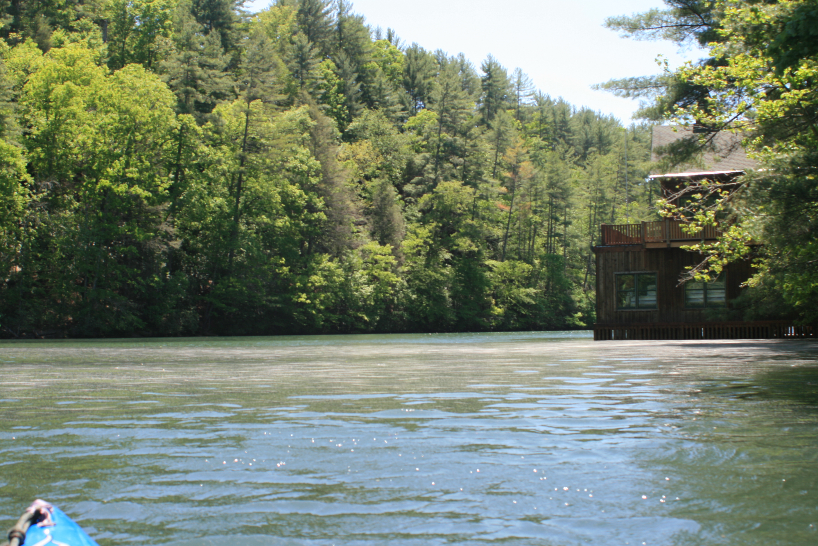
Timpson Cove
The days tentative paddle plans were to start from the Anchorage Marina (Timpson Cove) on the Northeast part of the lake – or – from the Moccasin Creek State Park ( Moccasin Creek ) on the Western side.
On arrival and upon entering Timpson Cove it was apparent that Burton had suffered a hard storm. The previous weekend there had been a record number of tornadoes rumble through the South – three hundred folks had died from Alabama northward.
While planning the paddle I received the word that Burton had taken one of those tornadoes, so I had ‘laid back’ until this date (Wednesday) from paddling – Timpson Cove was a mess of tangled trees and downed power lines.

Burton Fish Hatchery Ramp
(GPS – @ 282 Landing Ln, Clayton, GA)

Moccasin Creek

Moving on to the West side, Moccasin Creek State Park at first appeared in better shape, and after asking a few questions I ‘checked out’ the Park; spaces were available for camping and the park was well managed. Beside the Park was the Burton Fish Hatchery and boat ramp – available for day use only (no overnight parking) with no fee – that would be my put-in.

With the Burton fish hatchery next door to the State Park and Moccasin Creek running between the two I felt sure that it could be a magical place for a kid to catch a trout in the summer – even noticed that they had one area marked off specifically for kids and seniors – 173 trout waters.

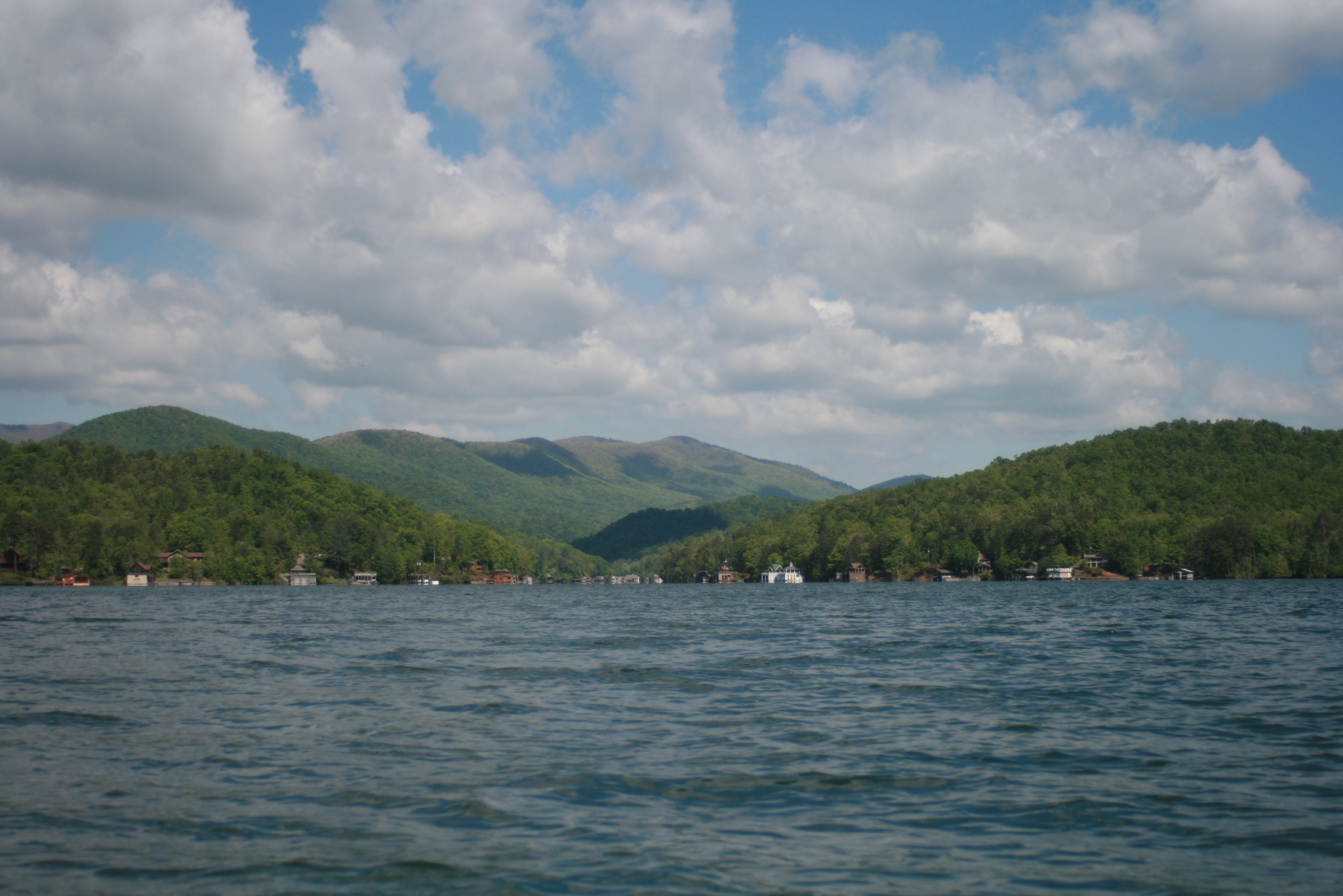
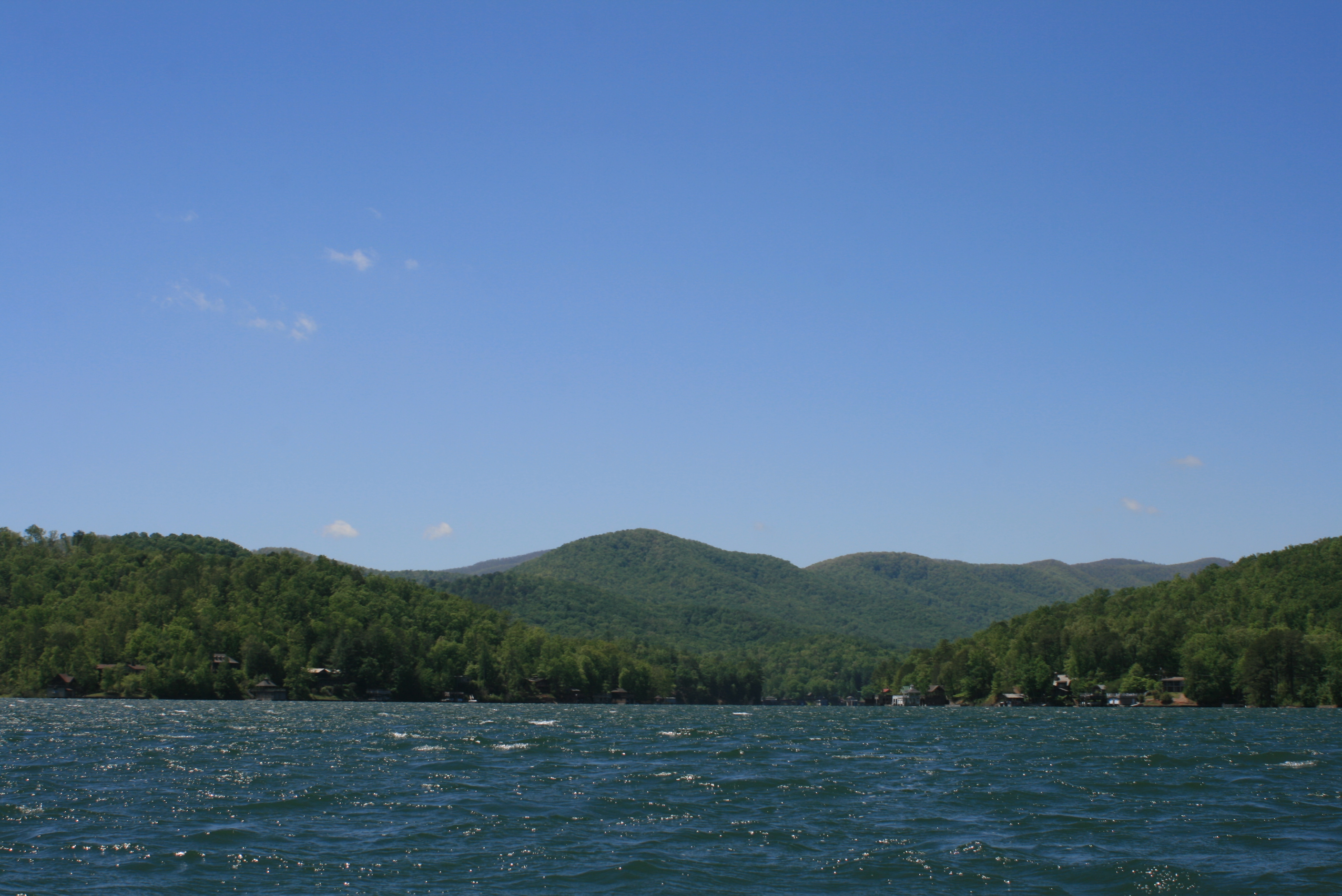
“Lake Burton has a water surface area of 2775 acres with 62 miles of shoreline ” (chart).
Due to the size of Burton more than one day would be needed to paddle and appreciate her character, and it was along these thoughts that my trip objective for this date was to simply paddle to the Northermost point of Burton’s Tallulah river-bed and then work my way back to Moccasin Creek – I would head back at three pm no matter where I happened to be, it was now 930 am.

As I paddled out east from Moccasin Creek it was easy to notice where the Tornado had slammed the mountainside ahead.

This is the direction the storm passed blowing one home completely into the lake before crossing and striking the opposite shore in front of me –


– and then striking the mouth of Timpson Cove beyond that.


 Moccasin Creek rd.

Complete and devastating damage to those in her way. I paddled away impressed with how the winds had sheared the trees off midway, a clean cut – like a ‘flat-top’ haircut. In awe also with how easily the winds had dismantled and so thoroughly scattered the buildings throughout the scalp.
I came to paddle Burton’s character not to gawk at someones losses, but wow – couldn’t help but to feel for them. Not everyone suffered damage, but it was easy to sense how each member of Burton’s lake community had been affected.

There remained some sense of normality further North in the main channel – well, until I paddled nearer to Timpson Cove,

– in the distance I could see where the tornado’s blast had once again delivered its turbulent and very authoritarian message along Meeting House Mtn rd.


Trampoline wrapped around a tree
The trampoline ‘caught my eye’ because this tree was along the shoreline – leaving me to ‘consider’ that the trampoline had traveled quite a distance across the lake before striking the tree. The harsh winds certainly didn’t touch all of Burton’s shores, but in the places where it did – it devoured.

Once again I moved away, touched – and thinking too of the powerlessness of experiencing an active storm. In Florida, I remembered experiencing Hurricane Donna as a child, our house rattled as my father “held’ our roof from peeling-off during the high winds, then as the eye of the hurricane passed and the wind changed direction, the large trees fell like leaves – Burton’s tornado was swift and sudden.
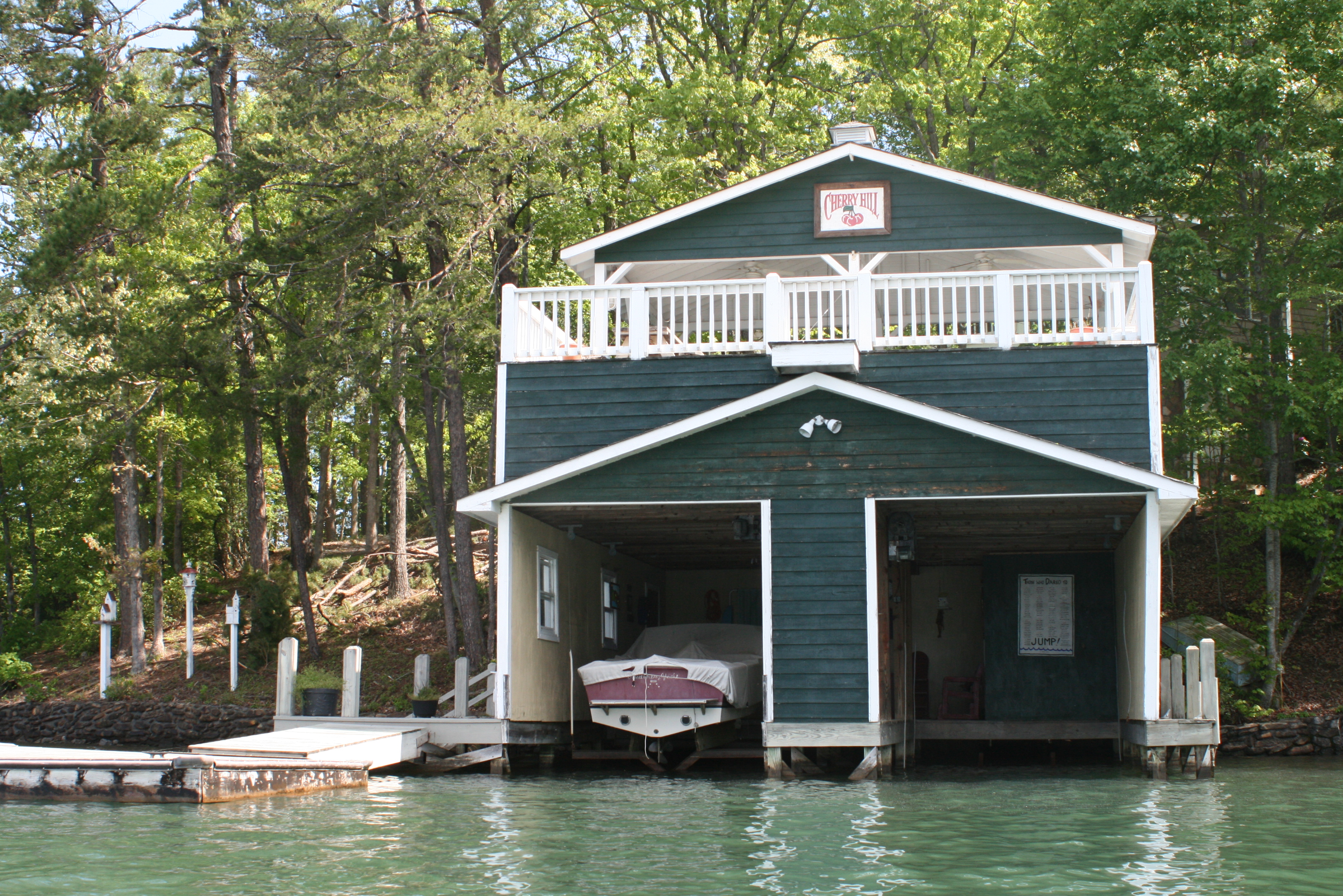

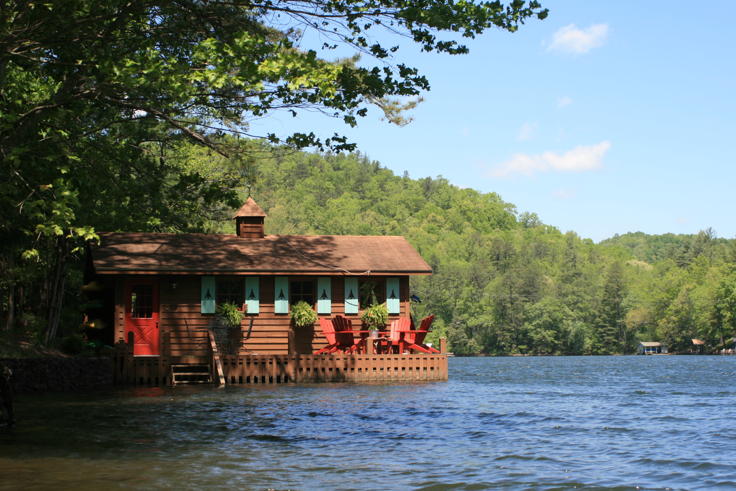
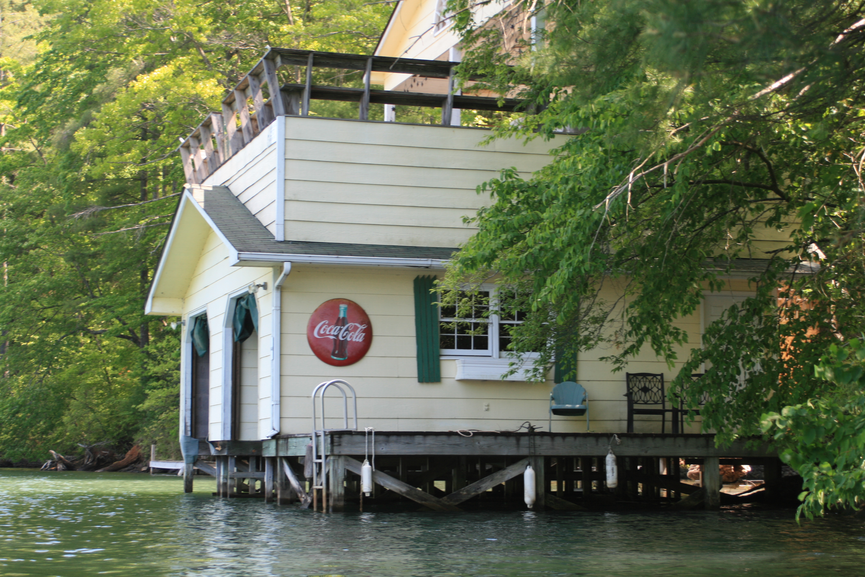
On Burton there were many more places undamaged than damaged – the boathouses of Burton are great, I love how everyone puts their own little ‘stamp’ or twist on these little wooden islands.


Hwy 76 bridge
Noon at the Highway 76 bridge, still headed further up the Talullah bed.
 and past YMCA’s Camp High Harbour


Things seemed a little more simple up here, I liked that.

Max Northeast Lk Burton point

Max Northwest Lk Burton pt

I hadn’t met my turn-around time but I had reached my distance objective – it was 130, four hours after leaving Moccasin Creek. After understanding the violence of a passing tornado’s wrath it was good to feel the peace that Burton’s corners continue to offer.


I also liked the stillness of its coves and the ‘little less than civilized’ nature surrounding its homes, so far paddling had not been difficult at all, after paddling the Suwannee a few weeks back, it was a good change to be back on still waters.

In one area the spring pollen was spread across the water like a satin sheet.


Back to the character of Lake Burton, boathouses – and reflecting the signs of our economic times – homes for sale, a ‘buyers market’ (they’ll let you make payments!).
As I crossed Dicks Creek Cove the wind had really picked up from the West, the whitecaps were starting to grow.

Burton Cemetary
I know that this is not a vivid picture, but there are markers in the main channel at Moccasin creek that indicate a submerged cemetery from many years past – “Here lies Jake, six feet under – Burton lake.”


Then a paddle back up Moccasin Creek from whence the wind had blown, on one boathouse I noticed a clock stopped at 5:45, I suspected as the storm rumbled through.


and the wind continued to blow from the West, all the way back to the ramp (center).

I watched the two guys above nail our country’s flag up before gazing into the remains of their boathouse, it made me wonder just how pride mixed with the hurt of what they were staring into.
I suppose there are points in our lives where we are challenged with ‘the hand we have been dealt,’ and realizing – that it’s not always the worse place to be…..

I will return in the next couple of weeks to paddle Cherokee, Murray and Wildcat Coves’ on the southern end of Burton. Burton is a beautiful lake and nothing about that has changed, except maybe that this community might be a little stronger now.
.
– whenever possible, please “Buy American”


May 05, 2011 @ 19:11:22
As usual, Tom, you touch me with your pictures and your words. I keep finding myself considering the difference of feet in the path of tornadoes. We lived in a trailer in Fort Myers when Hurricane Donna came through. We evacuated to the high school with Dad, while Mom went to work at the hospital. I remember her telling us that it was possible that our home would be gone when we came back, but to not worry because we would still be together. I was walking down the high school main hall with a Red Cross lady when the roof to the auditorium was ripped open. Our home was still standing, but the three trailers around us weren’t. All that happened to us was a little bent corner on our awning. Those few feet sometimes make a really big difference.
LikeLike
May 06, 2011 @ 09:05:01
Thanks Jeanie, many of us were ‘hunkered’ down during Donna – it was an early lesson, especially seeing the devastation afterward at Bonita Springs. Lake Burton had at least three areas that were ‘pounded’ in the same manner. We appreciate the beauty and peace of mother-nature, but her beastliness reminds us of the dues that must be paid.
LikeLike